
(Click on any image below for a larger version)
Tuesday, January 23: Weddell Sea
Following our exploration of Paulet Island, the Hanseatic set course back to the Antarctic Sound through the Weddell Sea.
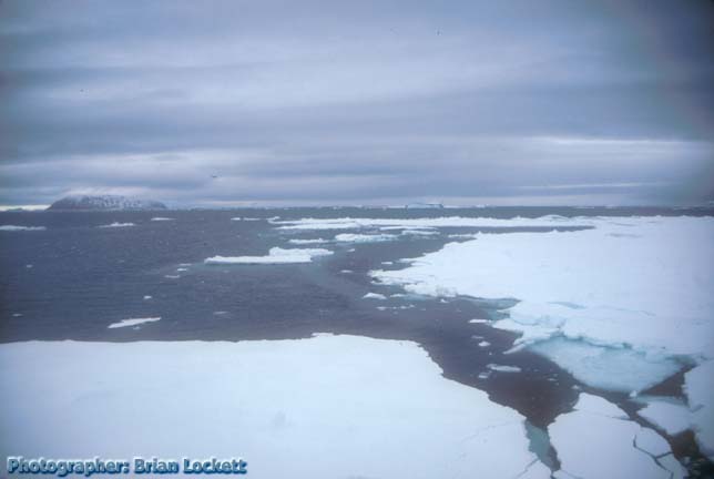
Several ice sheets feed into the Weddell Sea and there is a lot more floating ice there than there is on the other side of the peninsula. Icebergs of all sorts filled the water around the ship.
Floes of low lying sea ice are scattered throughout the sea. Sea ice is seawater that has frozen during the winter. It is just a few feet thick.
Visit the Sea Ice Home Page of the Ocean Modeling Branch of the Environmental Modeling Center
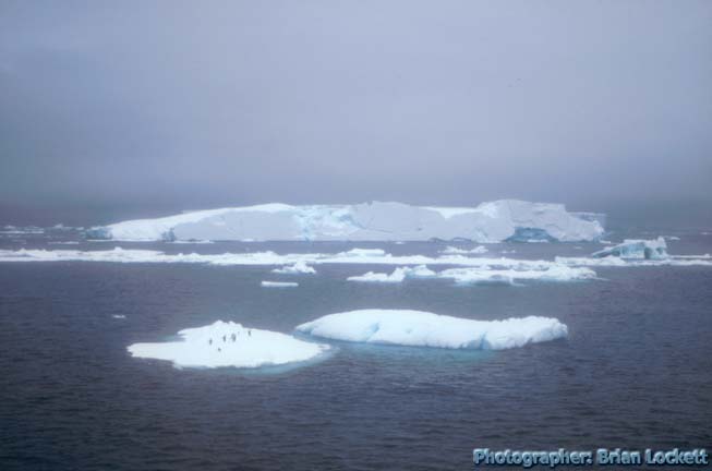
Most of the small ice floes that we passed had penguins on them. Although the penguins had not paid much attention to the Zodiacs as we cruised around the floes, they invariably ran or tobogganed away from the ship as it approached, leaping into the water on the far side of the floe.
The forecastle (pronounced focksel), the open deck directly above the bow, was opened to the passengers. Captain Notke selected one of the ice floes and steered the ship directly toward it. The ship slowed as we approached the ice.
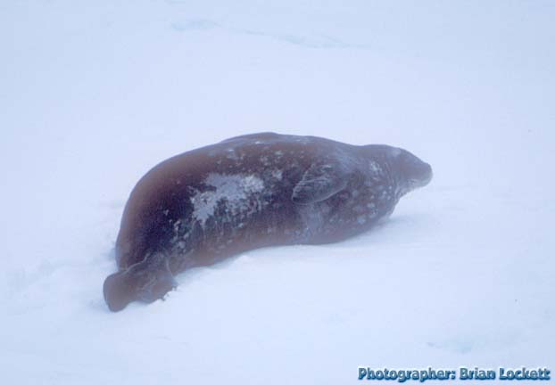 A solitary Weddell Seal was lying quietly on
the ice floe. Weddell Seals are "true seals". They have
no external ear flaps and their hind limbs are more adapted for
swimming and less useful for propulsion on land or ice. They are
gray with dark spots.
A solitary Weddell Seal was lying quietly on
the ice floe. Weddell Seals are "true seals". They have
no external ear flaps and their hind limbs are more adapted for
swimming and less useful for propulsion on land or ice. They are
gray with dark spots.
Link to information about the Weddell Seal from the Sierra Club Handbook of Seals and Sirenians.
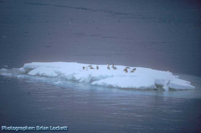
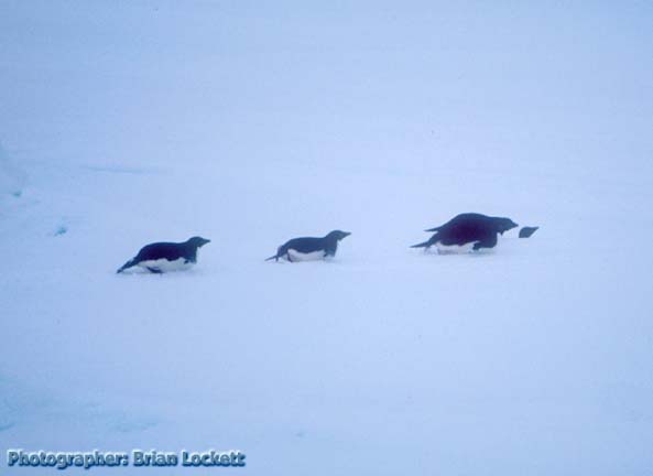 A flock of Adelie Penguins warily observed our
approach and then started tobogganing toward the far side of the
floe.
A flock of Adelie Penguins warily observed our
approach and then started tobogganing toward the far side of the
floe.
Background information about the Adelie Penguin.
The bow of the ship struck the ice floe and large cracks propagated rapidly across the ice. The Weddell Seal lifted its head and looked toward the ship, as if to decide if it should move or just go back to sleep. The penguins jumped off the floe and swam away.
Captain Notke ordered more power to the screws, and the ship plowed into the crack that had opened up in front of it. It pushed the smaller part of the floe to one side and crossed through the floe to the open water on the other side. We passed many more ice floes carrying penguins and a few more solitary Weddell Seals.
 Paulet Island could be seen behind us as the ship plowed through
the pack ice.
Paulet Island could be seen behind us as the ship plowed through
the pack ice.
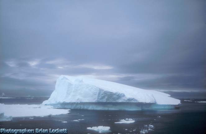
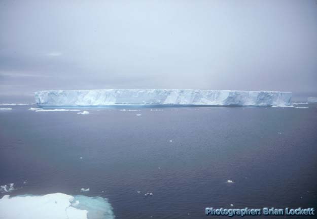 The largest were tabular icebergs that had been calved from the
great ice sheets floating on the sea farther to the south.
Tabular icebergs are flat on the top and can be miles across. The
part out of the water is taller than the Hanseatic, over 60 feet
tall, and the part under the water goes several times deeper than
that. They have vertical sides that show relatively fresh
fracture faces. They are made of the bluest, oldest ice.
The largest were tabular icebergs that had been calved from the
great ice sheets floating on the sea farther to the south.
Tabular icebergs are flat on the top and can be miles across. The
part out of the water is taller than the Hanseatic, over 60 feet
tall, and the part under the water goes several times deeper than
that. They have vertical sides that show relatively fresh
fracture faces. They are made of the bluest, oldest ice.
 This appears to be part of a tabular iceberg that has rolled over
onto its side. The flat surface was originally the top of the
iceberg.
This appears to be part of a tabular iceberg that has rolled over
onto its side. The flat surface was originally the top of the
iceberg.
 There were also many smaller icebergs of irregular shape, which
had calved from the faces of glaciers near the shoreline. As they
melt from below, they occasionally roll over. The toppled
icebergs have indented lines around them that mark where they had
eroded along the previous waterlines. The ice of these bergs
takes on an infinite variety of forms. They frequently have a
mantle of white snow draped over the old, blue ice from the
glacier.
There were also many smaller icebergs of irregular shape, which
had calved from the faces of glaciers near the shoreline. As they
melt from below, they occasionally roll over. The toppled
icebergs have indented lines around them that mark where they had
eroded along the previous waterlines. The ice of these bergs
takes on an infinite variety of forms. They frequently have a
mantle of white snow draped over the old, blue ice from the
glacier.
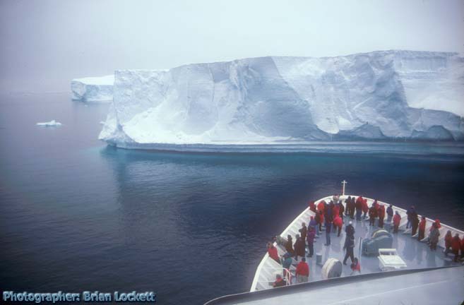 We
passed through an area with many large tabular icebergs that had
been grounded on the sea bottom. The ship steered a course
through the maze of blue icebergs. Captain Notke selected one of
the bergs and brought the bow of the Hanseatic to within a
hundred yards of the vertical ice face. Icicles hung from the
overhanging parts of the face of the berg. It had the usual
indentation at the water line.
We
passed through an area with many large tabular icebergs that had
been grounded on the sea bottom. The ship steered a course
through the maze of blue icebergs. Captain Notke selected one of
the bergs and brought the bow of the Hanseatic to within a
hundred yards of the vertical ice face. Icicles hung from the
overhanging parts of the face of the berg. It had the usual
indentation at the water line.
 The large, low-lying floes are very popular with the penguins.
The penguins fly out of the water and land on top of the ice,
where they gather in large numbers.
The large, low-lying floes are very popular with the penguins.
The penguins fly out of the water and land on top of the ice,
where they gather in large numbers.
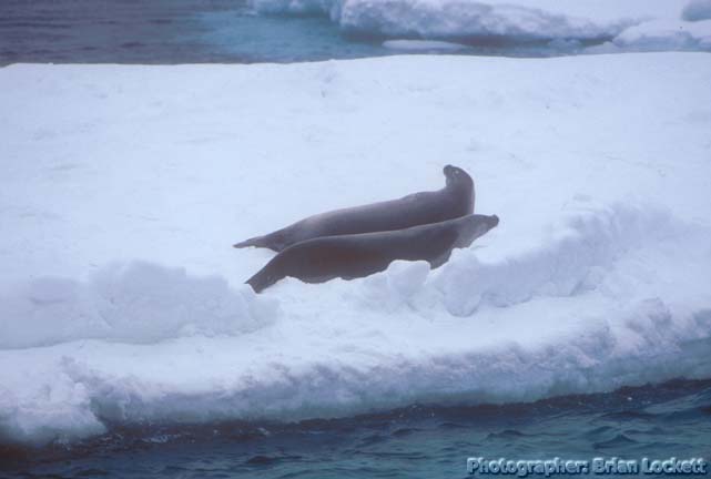
 Ice Floes are also very popular with Crabeater Seals. Crabeater
Seals are the most common seals. Despite their name, crabs do not
constitute the larger portion of their diet. They eat more fish
and squid. Their fur is tan to brown and more uniform in color
than the fur of the Weddell Seal.
Ice Floes are also very popular with Crabeater Seals. Crabeater
Seals are the most common seals. Despite their name, crabs do not
constitute the larger portion of their diet. They eat more fish
and squid. Their fur is tan to brown and more uniform in color
than the fur of the Weddell Seal.
Link to information about the Crabeater Seal from the Sierra Club Handbook of Seals and Sirenians.
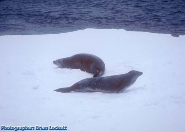
 This pair of Crabeater Seals was taking shelter behind a low ice
ridge.
This pair of Crabeater Seals was taking shelter behind a low ice
ridge.
Leanna, one of the contingent of naturalists aboard the ship, had just come from eating lunch and was watching the seals through the window. She wasn't dressed for the outside weather, so every once in a while she would open the door a little and yell out to us what we were seeing.
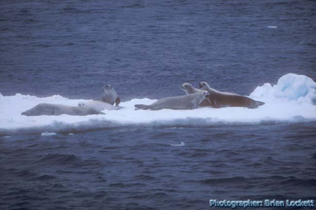 Crabeater Seals were laying about on the ice in large groups.
We circumnavigated Dundee Island and entered the sound between it and Joinville Island, which is an extension of the Antarctic Peninsula. There was a lot of sea ice in the narrow sound between the islands.
 A Cape Petrel patroled its cold and lonely territory.
Link to information about Petrels and other Birds of the Antarctic.
Joann Stock presented a lecture about Antarctic Volcanoes after lunch. Paulet Island is a volcano and we would be visiting another larger volcanic island in a couple of days, Deception Island. The central crater of Deception Island is a caldera. So much material erupted from the magma chamber under the volcano that the center has collapsed, very much like Crater Lake in Oregon. One part of the crater wall has collapsed, creating an entrance into the large harbor in the caldera. Eruptions at Deception Island have been recorded frequently over the last two hundred years. The last major eruptions were in 1969-70.
These volcanoes are located on tectonic plate boundaries and are explained as the result of magma upwelling along the faults. There is a region of volcanism on the Continent of Antarctica, which is not near a plate boundary. The source of those volcanoes is not well understood, and it has been suggested that there is a hot spot of upwelling in the mantle below the crust in that region.
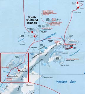 Map of the Antarctic Peninsula.
 Table of
Contents
Table of
Contents Send a message to Brian.