 (Download a higher resolution picture
by clicking on any picture below.)
(Download a higher resolution picture
by clicking on any picture below.)
Camino Cielo, the Road in the Sky, October 21, 2004 |
(Download a higher resolution picture
by clicking on any picture below.)
On Thursday, October 21, I shot a series of panoramas along the length of East Camino Cielo on the crest of the Santa Ynez Mountains above Goleta and Santa Barbara. Camino Cielo features many sweeping vistas of the Santa Barbara Channel and the San Rafael Wilderness.
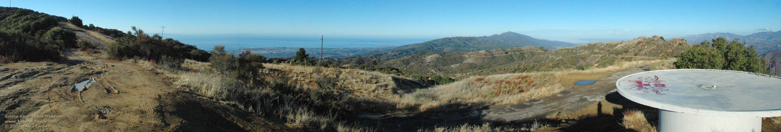 Our journey begins about four miles from the intersection of Highway 154 and Camino Cielo. The City of Goleta is on the south coast of Santa Barbara County. Santa Ynez Peak is the high point on the ridge in the distance. The gray structure at right is a cistern that collects rain water for fighting fires.
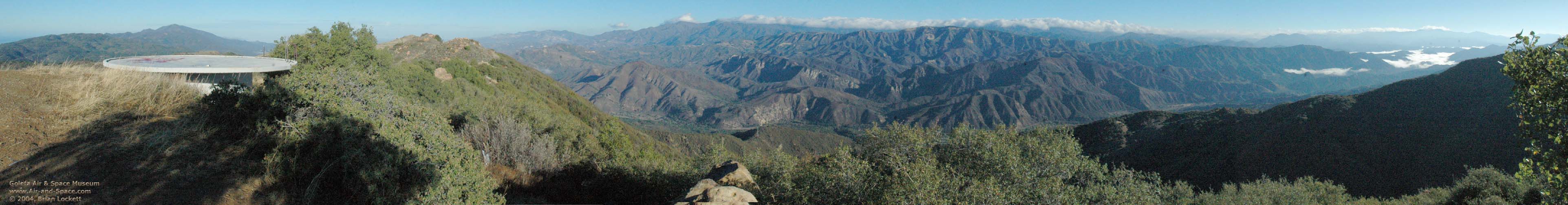 That is the same cistern that appears in the previous panorama. Santa Ynez Peak is on the left side of this panorama. San Rafael Mountain is the highest peak in the cloud shrouded San Rafael Mountain Range on the horizon. Old Man Mountain, Alexander Peak and Little Pine Mountain are the high points on the ridge in the foreground. Fog shrouds Gibralter Lake and Little Caliente Canyon in the upper reaches of the Santa Ynez Valley. Pine Mountain, in Ventura County, is the high peak on the horizon near the right side of the image.
 The Goleta Valley and Santa Barbara Channel are at the left. Santa Ynez Peak is at center, and the San Rafael Mountains are at right.
 Cathedral Peak appears at the left. The City of Santa Barbara is visible in the gap to the right of Cathedral Peak. Santa Cruz Island is on the horizon between Santa Barbara and the Goleta Valley. Figueroa Mountain and the San Rafael Mountain Range are at right.
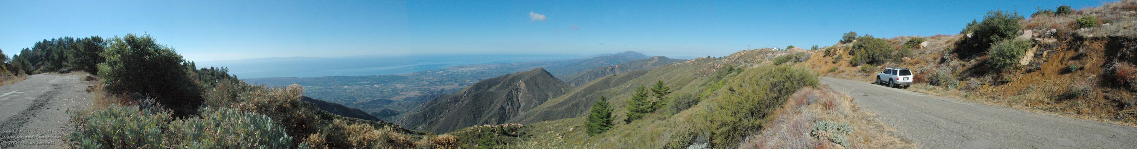
 Above the San Roque district. Pines cover the top of La Cumbre Peak at left. Santa Rosa Island and San Miguel Island are lost in the mist to the west of Santa Cruz Island. Radio repeaters and a VHF Omnidirectional Radio (VOR) navigation facility dot the ridge of the Santa Ynez Mountains.
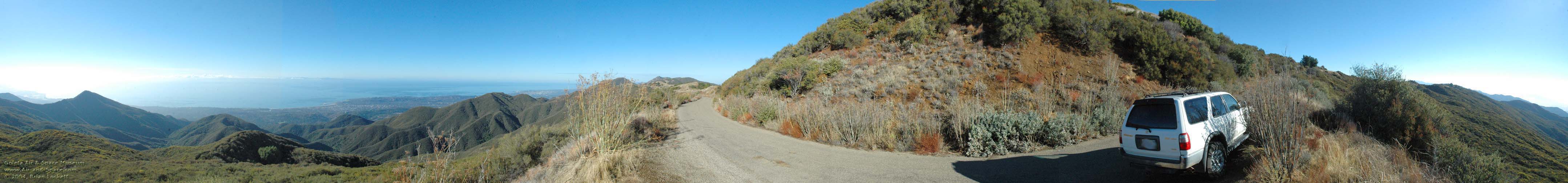
 This was taken a short distance to the east of La Cumbre Peak. Santa Cruz Island is at far left. The Goleta Valey is at center and Santa Ynez Peak is on the horizon to the right of center.
 This is a full 360-degree panorama. Loon Point is nearly lost in the glare at far left. Montecito Peak stands out against the sunlight reflected off the Santa Barbara Channel. The lagoon at the Andree Clark Bird Refuge can be seen to the left of the City of Santa Barbara. The Goleta Valley is visible through the gap near center. La Cumbre Peak on the far side of Angostura Pass is the high point on the horizon near center.
 This is a full 360-degree panorama taken above Montecito, half-way from the intersection with Gibralter Road and Cold Springs Saddle. The lagoon at the Andree Clark Bird Refuge is right behind the dead Century Plant at left. A lonely cumulus cloud hovers over Santa Barbara. The Goleta Valley is just visible in the gap to the left of the big Juniper Tree. Gibralter Lake peeks through a gap in the chapparal just to the right of the ridge. Little Caliente Canyon and Hildreth Peak are at middle right. Juncal and the Murrietta Divide are at far right.
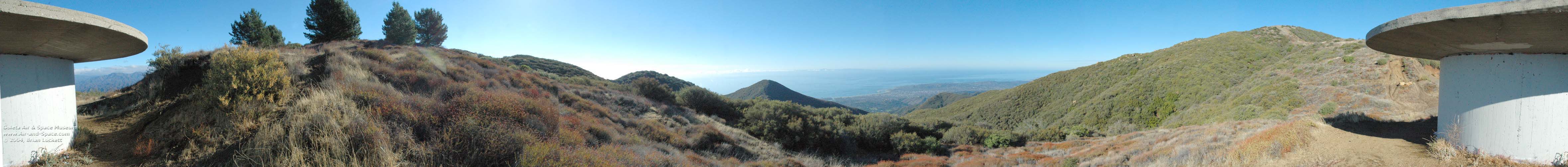 This is a full 360-degree panorama taken at Cold Spring Saddle, the trail head of the Cold Springs Trail. It is a 2,600-foot ascent from Mountain Drive. The San Rafael Mountains peek through the opening under the lid of the cistern at left. The Andree Clark Bird Refuge is just visible to the right of Montecito Peak. Montecito and the City of Santa Barbara are near center.
 This is a full 360-degree panorama taken between Cold Spring Saddle and Romero Saddle. The Santa Barbara Channel can be seen on the south side of Camino Cielo. Looking toward the north, Forbush Flats is at the base of the Santa Ynez Mountains in the foreground. Hildreth Peak is sihouetted against the clouds to the right of the fog shrouded Little Caliente Canyon. Cloud topped Pine Mountain, in Ventura County, is the high peak on the horizon near the right side of the image.
 This is a full 360-degree panorama, taken near Romero Saddle at the east end of Camino Cielo. Santa Cruz Island is just visible over Camino Cielo at left. Agua Caliente Canyon leads off into the distance at the right. Juncal and the Murrietta Divide are at far right.
Send a message to Brian.